Lychakivskyi Park ID: 2012
Lychakivskyi Park is a small public park located in the northeastern heights of Lviv near the intersection of Lychakivska and Pasichna Streets. A landscaped park was laid out originally in 1892 by Lviv’s celebrated park architect and long-time “park inspector” Arnold Röhring. Lychakivskyi Park is well-removed from the Lviv city center, and is one of its most popular ‘getaways’. Prominent among the park’s trees are its Black Pines.
Story
The thirty years preceding the First World War were a period of rapid territorial expansion, aggressive construction, and dynamic growth and development of Lviv’s park and garden system. These processes were assisted by improvements in the city’s communications and tram system, which connected it with its outlying regions like those of the heights of Lychakov. Once the city’s eastern edge, the heights were annexed by Lviv in the late-19th century, and it was in the region of these Lychakov Heights that a public city park was founded, called Lychakivskyi.
Historian Ivan Krypyakevych retells a colorful legend associated with the territory on which the park now sits: “On Lychakivskyi Hill, where the park is now, stood a ruins known as “the Demon Mill”. A certain entrepreneur desired to put the wind on Lychakivskyi Hill to good use and built a stone and brick windmill. But the wind destroyed the blades of his windmill and the owner soon deserted his mill, leaving an empty structure where the Lychakov folk often observed a colony of demons”, (Krypyakevych, 1991, pp 96-97).
And so, on this territory of “the Demon Mill”, east of the Lychakiv Cemetery and Tsetnerivka neighborhood, a park was established to revive the landscape of this outlying area of the city’s third administrative district. FranciszekBarański’s guidebook to the city contains the following: “Established in 1892 on sandy ground….with afforestation this once bare patch of earth was turned into a wonderfully verdant space. Provided with kiosks…and benches for the benefit of those who walk there” (Barański, 1902, p105).
The park was designed by Lviv’s leading landscape architect of the last third of the 19th and early-20th centuries, and long-time “park inspector”, Arnold Röhring.
In 1896, near the park’s lower terrace, a stadium was built by the Polish “Sokil” Sports Group.
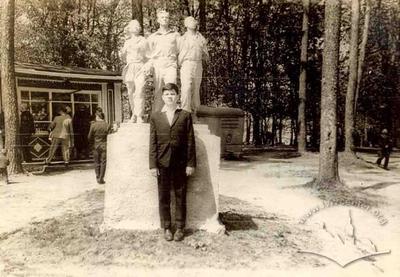
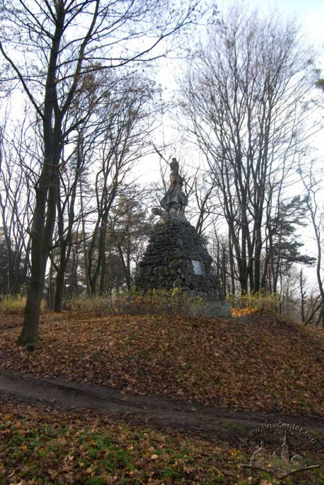
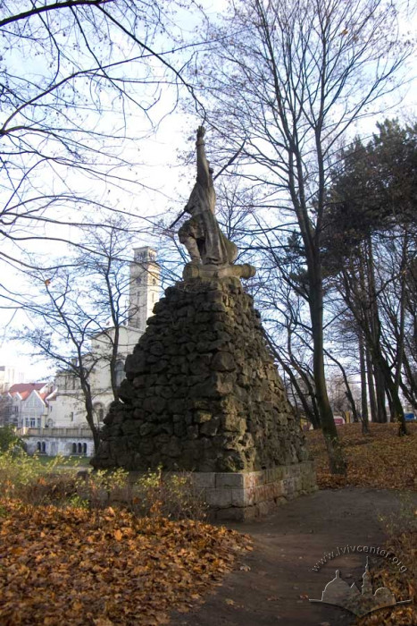
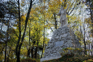
In 1906, on the high ridge from the Lychakivska Street side a monument designed by Julian Markowskiwas erected in honor of WojciechBartoszGłowacki, hero of the Polish uprising under Kościuszko. Until the Second World War the official name of Lychakivskyi Park was Głowacki Park.
During the First World War a Russian Military Memorial Park was established near Lychakivskyi Park. It would later be reconstructed and expanded to become what is known as “Glory Hill”.
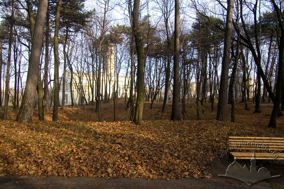
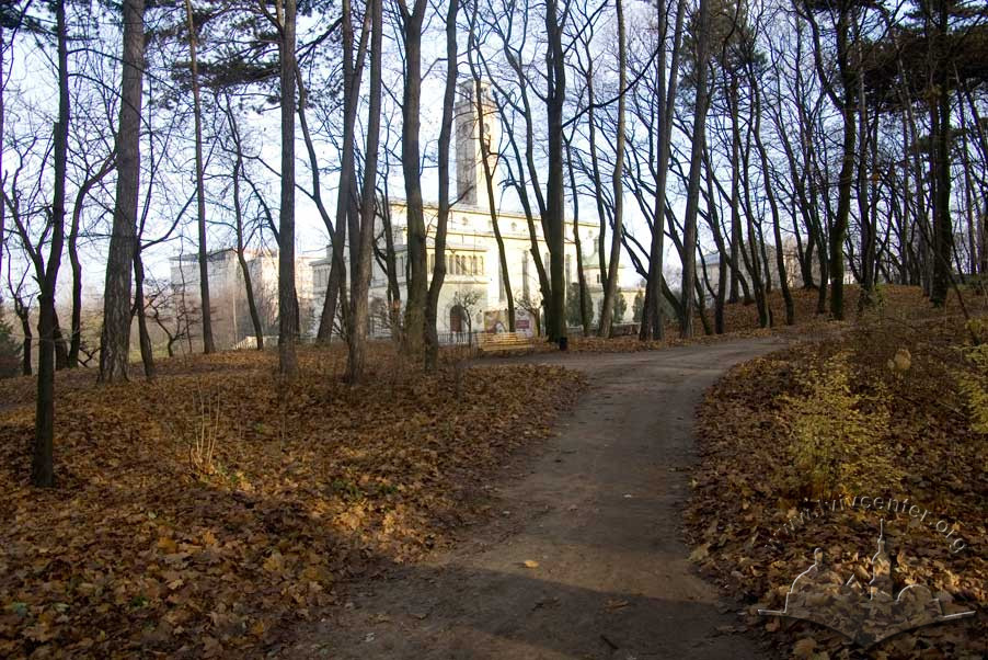
In the first half of the 1930s on the territory adjacent to the park the Ostrobrama Theotokos Cathedral (currently, Intercession of the Theotokos Cathedral) was built from a design by Tadeusz Obmiński.
Lychakivskyi Park is located away from the city center, providing residents with an excellent place to relax in one of the city’s coziest getaways.
Architecture
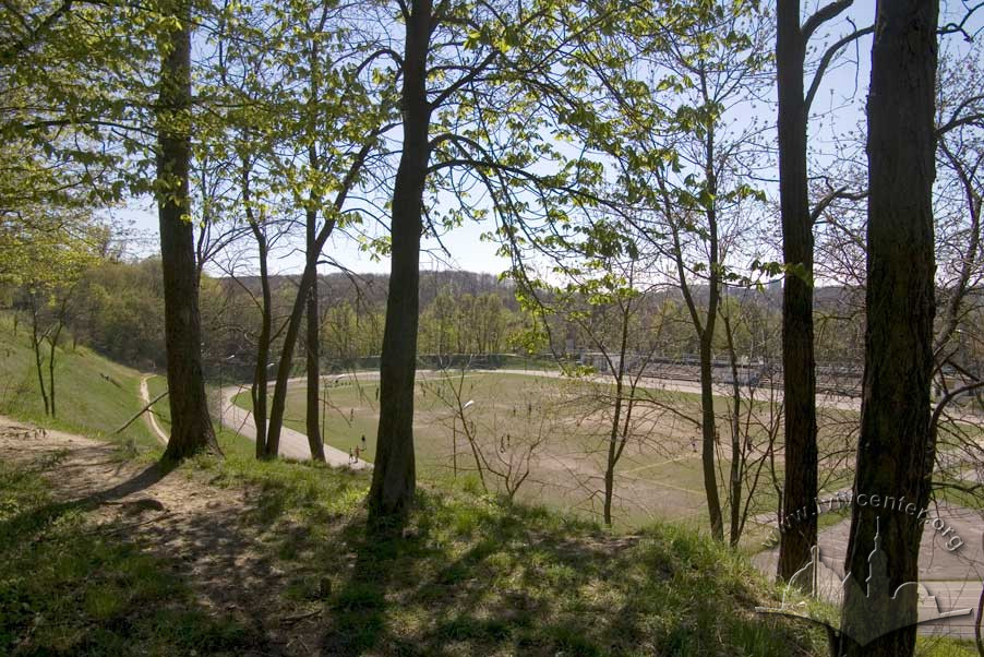
Lychakivskyi Park sits at the corner of Lychakivska and Pasichna streets, in the northeastern part of Lviv near the Glory Hill Memorial Park and Lychakivskyi Cemetary. On its northern border sits the Lviv University Sports Complex, on its western, the SKIF Stadium whose amphitheater touches on park property. The park is surrounded by Stadiums and Cemeteries – two of each.
The most impressive accent of the architectural ensemble surrounding the park is the Ukrainian Greek Catholic Intercession of the Theotokos Cathedral (formerly the Ostrobrama Theotokos Cathedral) set on a hill across the street from the park on Lychakivska Street.
Lviv Tramline #2 travels to the park which sits at the terminal stop at the start of Pasichna Street.
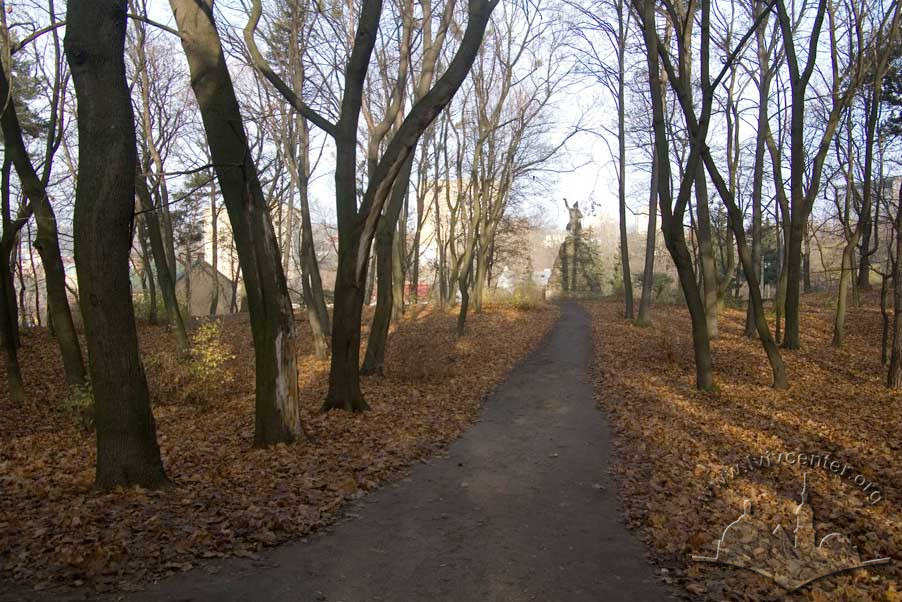
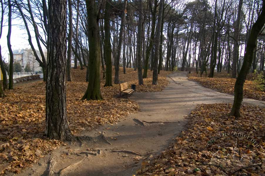
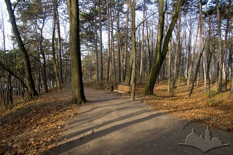
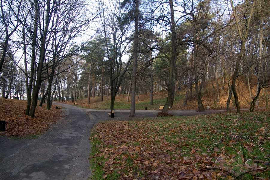
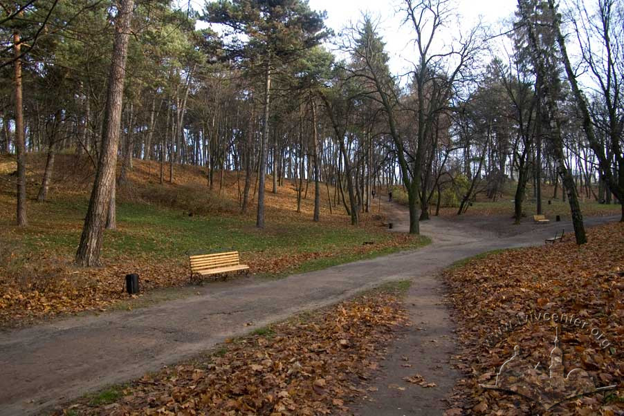
Lychakivskyi Park is located on picturesque sandy hills rising above the eastern end of the Lviv valley. The natural terrain of the park determined the form the park was to take in the design of landscape architect Arnold Röhring, whose plan would contrast the later, structured style of “Glory Hill”. Spots along the winding paths to the top of the park provide repeated outstanding views of Zamkova Hora (Castle Hill) and Lviv’s city center. At the top of the ridge in the north end of the park, adjoining Lychakivska Street, stands the WojciechBartoszGłowacki Memorial.
Near the end of the 19th century on the territory of the newly constructed public city park (8.4 hectares at the time of its construction), birches and coniferous trees were planted in the sandy soil of the Lychakivskyi Heights (Kowalczuk, 1896, p320).
A particular feature of the Lychakivskyi Park woods are the prominence of its Black Pine trees. Maples, linden, chestnut, and shrubby growth also grow here. Olena Stepaniv writes: “The park vegetation is thin here, because the soil is sandy, mixed with limestone rubble. Pine, fir, birch, and Black Pine grow here. Entrance to the park is from Lychakviska Street (tram #1) and Pasichna Street” (Stepaniv, 1992, pp46-47).
According to the 1925 guidebook written by Mieczysław Orłowicz, at the start of the 1920s Lychakivskiy Park occupied 6.1 hectares (Orłowicz, 1925, p8). It was later expanded to included the vacant ground between it and “Glory Hill”. Currently the park covers 12.36 hectares.
Related buildings and spaces
-
Lychakivskyi Park territory – monument to Bartosz Glowacki
People
Franciszek Barański –
ethnographer, guidebook author
Wojciech Bartosz Głowacki
– Polish partisan
Tadeusz
Kościuszko – leader
of the Polish uprising
Ivan
Krypyakevych – historian
Julian
Markowski – sculptor
Tadeusz
Obmiński – architect
Mieczysław
Orłowicz – ethnographer, guidebook author
Arnold
Röhring – landscape architect, park designer
Olena
Stepaniv – historian, geographer, civic activist
Sources
- Ivanochko, U., et al. “The Architecture of Historicism of the 1840s – 1890s”, Architecture of Lviv: Times and Styles, 13th-21st centuries. Biriulyov, Yuryi, ed. Lviv: Center of Europe Publishing, 2008.
- Krypyakevych, Ivan. Historical Walks Around Lviv. Lviv: Kamenyar, 1991.
- Stepaniv, Olena. Contemporary Lviv: A Guidebook. Lviv: Phoenix, 1992.
- Barański, F. Przewodnik po Lwowie: Z planem i widokami Lwowa. Lwów: 1902.
- Kowalczuk, M. Rozwόj terytoryalny miasta: Miasto Lwów w okresie samorządu 1870–1895. Lwów: 1896, pp. 299–351.
- Krajewski, A. Lwowskie przedmieścia: Obrazki i szkice z przed pόł wieku. Ze 16 rycinami w tekście Lwów: 1909.
- Orłowicz, M. Ilustrowany przewodnik po Lwowie: Ze 102 ilustracjami i planem miasta. Wydanie drugie rozszerzone. Lwów – Warszawa: Książnica-Atlas, 1925.
- Stankiewicz, Z. „Ogrody i plantacje miejskie”. Lwów dawny i dzisiejszy: Praca zbiorowa pod redakcja B. Janusza. Lwów: 1928, p. 62–71.
Material compiled by Ihor Zhuk, december 2012